")
")
")
Sanremo Romana and Villa Matuzia
The Romanization of the Ligurians
After having examined the prehistory of our territory, we will establish what is meant by "Ligurian population". It must be remembered that, when we talk about Ligurian populations, we do not only mean the coastal ones, because the territory where they were present was much larger and they went from the mouth of the Rhone, along the coastal strip, to the right side of the Arno river, including also wide swathes of the region now Piedmontese, reaching almost as far as Turin (see for example Novi Ligure, in the province of Alessandria).
 The tribes that made it up were first the intemeli (from Albintimilium, Ventimiglia), who controlled the territory from the course of the Armea torrent to the Turbìa hill above Monaco and northwards to the Tenda hill, including the entire Roia basin; then there were the ingauni (Albumingaunum, Albenga), which always controlled the territory from the Armea torrent, which was the border between the two, and controlled a vast area as far as the Porra di Finale torrent to the east, and touched the course of the Tanaro to the north. Still going towards the east there were the Sabazi (from Savo, Lodierna Savona), the Genuati (Genoa), other tribes further east and then to the north the Taurini.
 All these tribes were very hostile to any attempt of invasion and, while peaceful invasions took place by many Celtic tribes coming from the North that integrated so well as to create a new Celtic-Ligurian ethnic group, they were not happy with the commercial expansionism of the Greeks who had settled in Massalia (Marseilles) and strongly opposed them.
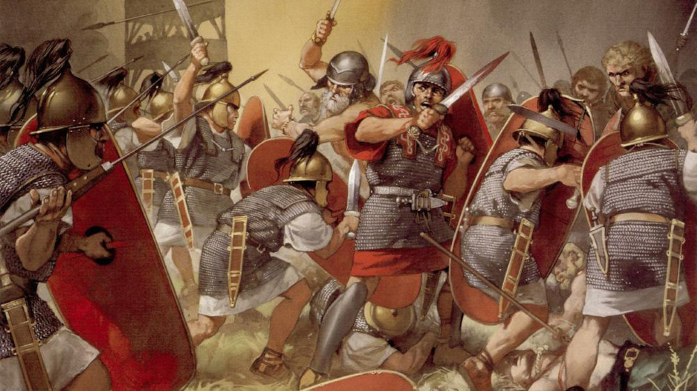 The Romans found the same hostility when in the III century B.C., having been right of the Etruscans and integrated their territories, they found themselves in direct contact with the Ligurians. The Roman expansionism, however, pointed towards the rich territories of Gaul and the Iberian peninsula (then under Carthaginian control), and the territory of the Ligurians was on their way (they controlled the Ligurian coasts and the southern
 Alps). At the beginning the Romans had a rather condescending attitude: the Ligurian territory was considered poor, while the fame of its warriors was well known (they had already met them as mercenaries), finally they were already engaged in the First Punic War (see here) and they were not willing to open new fronts; therefore they tried first of all to make them allies. However, despite their efforts, only a few Ligurian tribes made alliance agreements with the Romans (the alliance with the Genuatis was famous), and the rest of the tribes were immediately hostile. The Ligurians, momentarily allied with the Gauls Boi (https://it.wikipedia.org/wiki/Boi) tried to fight the Roman advance, but they didn't do much because the alliance broke up almost immediately, while a Roman fleet commanded by Quinto Fabio Massimo defeated the Ligurian ships on the coast (234-233 B.C.), allowing the Romans to control the coastal route to and from Gaul.
 With the outbreak of the Second Punic War (218 B.C.) the Ligurian tribes had different attitudes and different fates. Those of the west (intemeli and ingauni) allied themselves with
  the Carthaginians, while those of the east (the genuati, the tribes of the east and the Taurini) sided for the Romans. The Ligurians pro-Carthage provided help and soldiers to help Hannibal in his campaign, hoping for the expulsion of the Romans. With him and with Asdrubale Magone Barca, his brothers, at the beginning they obtained several victories: Hannibal, as soon as he crossed the Alps, attacked the Taurini (218 B.C.) and destroyed their capital and in 205 B.C., Genua was attacked and razed to the ground by Magone. The port of Savo, was used as a shelter for the triremes ships of the Carthaginian fleet, destined to cut the Roman trade routes in the Tyrrhenian Sea.
On the other hand, the pro-Roman Ligurians did not go as well at first. With the reversal of the destiny of the Second Punic War, we find Magone (203 B.C.) among the Ingauni, trying to stop the Roman advance: he suffered a serious defeat that also cost him his life; in the same year Genua was rebuilt. Ligurian troops are still present, as Hannibal's chosen troop, at the battle of Zama in 202 B.C., which decreed the defeat of Carthage.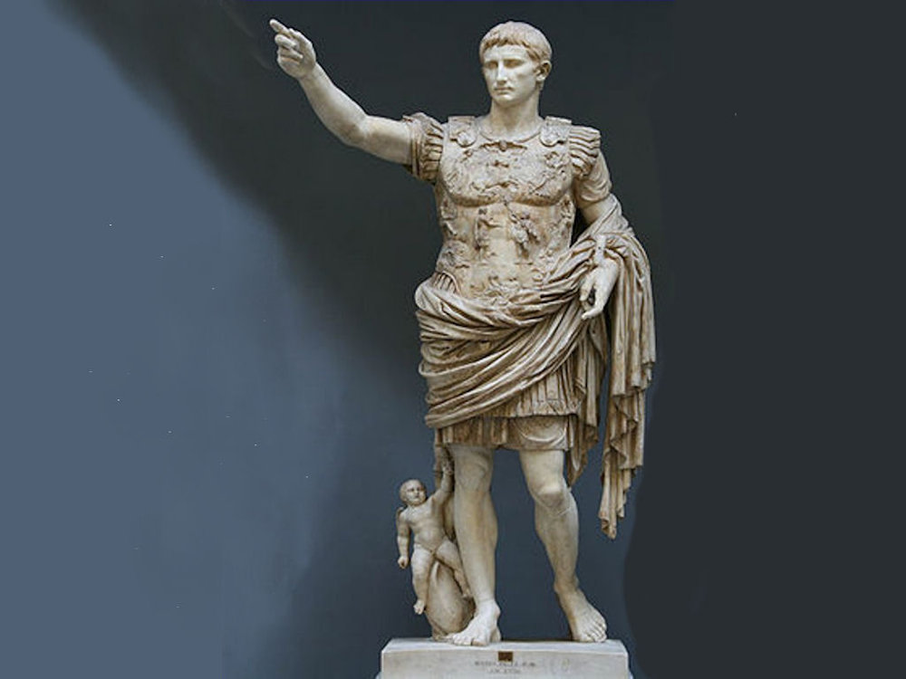
 It was at this point that the Romans, with the support of the Ligurian federations, took control of the territory, creating the IX Regio of the Roman Empire (called Liguria), which extended from the Maritime and Cottian Alps, to the Po, the Trebbia and the Magra. With the defeat of Carthage, however, the hostilities did not completely cease because immediately (197-155 B.C.) the Ligurians entrenched themselves on the Apennines, from where they periodically descended to plunder the surrounding territories. The Romans, for their part, organised continuous expeditions on the mountains, hoping to snide, surround and defeat the Ligurians (taking care not to be destroyed by ambushes). Throughout the war the Romans boasted 15 triumphs and at least one serious defeat. Rome, however, won the war and began the action to control the entire region, imposing in 180 B.C. with weapons a heavy treaty on the Ingauni, who had the task of keeping the coastal road free and safe for about 2 and a half km wide from the raids of the tribes of the interior. It was at this point that the Romans took control of the territory and created the IX Regio of the Roman Empire (called Liguria), which extended from the Maritime and Cottian Alps to the Po, the Trebbia and the Magra.
From that period began the process of Romanization of the region, which ended in the last century before Christ, with the achievement of Latin law (89 B.C.).


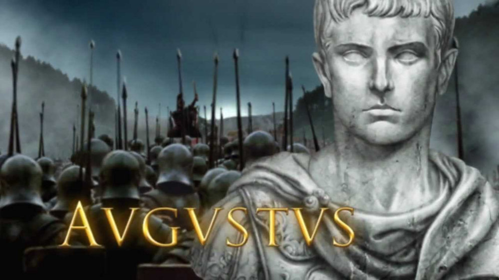
In 13 B.C. the new coastal road to Gaul was completed, called via Julia Augusta, from Vada Sabatia (Vado Ligure) to Varo (Var river, after Nice).
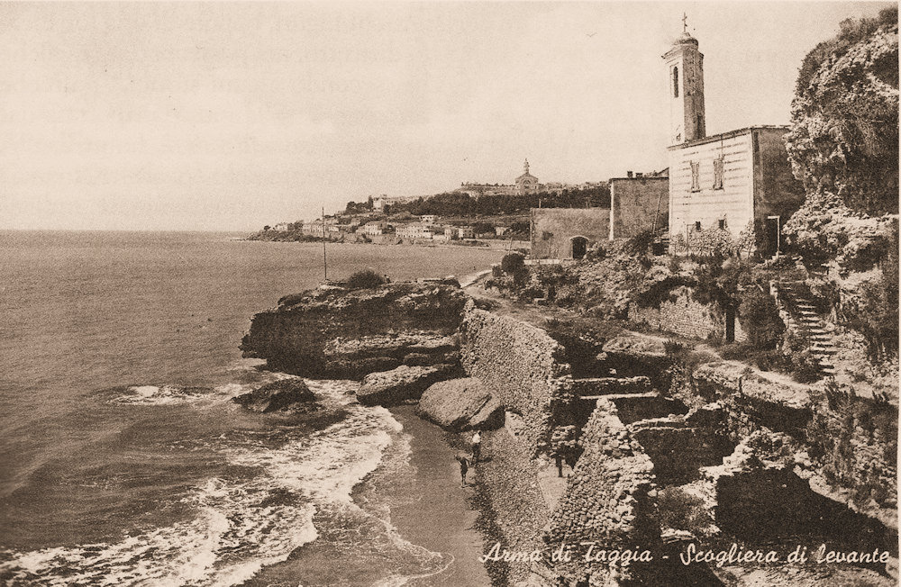 The route reached the Costa Balenae roadworks to the east of the mouth of the Tavia fluvius (the Argentina torrent), then penetrated a little to the north, crossed
 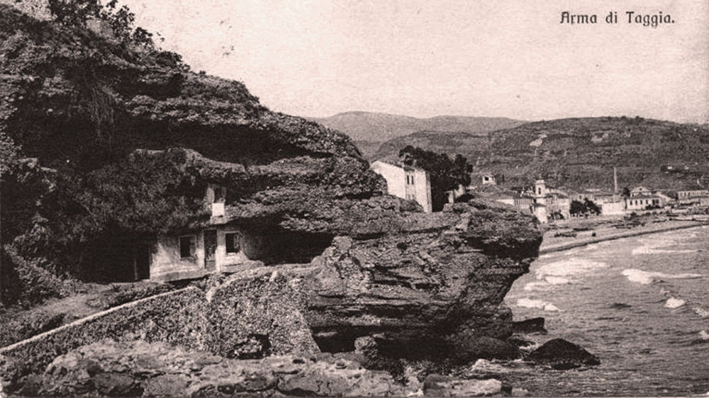 the watercourse perhaps with a ford and descended from the opposite side as far as the head of the Madonna dell'Arma near Bussana, which it bypassed passing on the outer edge of the conglomerate promontory. At the beginning of the century, in fact, it was still possible to see the cut made in the rock formation to create the roadway, which passed in front of the current entrance to the small rocky sanctuary of the Annunziata. The Armea torrent was also crossed a little inside the valley, so the Roman road followed the coast again according to the current route of the Via Aurelia, until today's Garibaldi's roundabout, for whose enlargement, in 1883 and 1901, the Roman bridge over the San Lazzaro torrent, discovered in 1823, was unfortunately destroyed.
  The bridge was made of stone ashlars distributed in regular courses and was five metres wide. Subsequently the Roman road followed the route marked by the current Via Palazzo and Via Corradi and, after a retreat to cross the river Foce, in correspondence with the remains (underground) of an ancient bridge, it reached
  Capo Nero always following the current route of the Aurelia, which it followed until the entrance of Bordighera Alta and continuing until Albintimilium (Ventimiglia). The road continued in Gaul as far as Narbona (Narbonne) but from Arle (Arles) it took the name Via Domizia. Along the ancient route in the Sanremo territory a milestone has been found: a stone of Augustus, found generically 'in oppido Sancti Romuli' and already preserved in the church of Santo Stefano. The stone bore the number DLXXIX.
Naturally the new consular road, in its course, favoured the rise and growth of small urban agglomerations, isolated farms and villas, farms (fundus) in the most favourable areas for cultivation, around which villages or small towns would later arise, destined to grow over time.
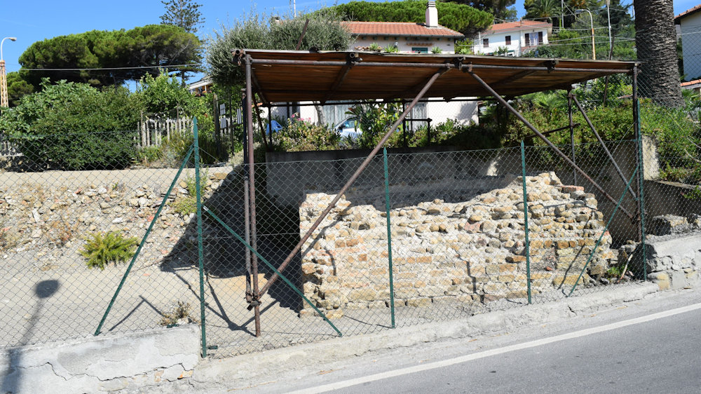
The most remote urban origin of Sanremo is to be found, however, in the heart of the village of Piano (planum ecclesiae Sancti Siri, 1210), where the late-medieval parish church of San Siro and the baptistery of St. John the Baptist are located, under whose floor, at the end of the fifties, the remains of a small agglomeration of the imperial age (1st-2nd century AD) were brought to light. C.) consisting of fragments of wall structures with stone blocks bound with mortar and scraps of ceramic containers, preserved in the Archaeological Museum of the city. The importance of the site had already been highlighted by the historian Girolamo Rossi, who handed down the news of the discovery of masonry finds and coins in 1636, at the time of the foundation of the new oratory of San Germano, next to the Baptistery, rebuilt after the damage suffered in the last World War and destined for Parish Works. The Roman nucleus must have been a small settlement along the route of the Via Julia Augusta, of which we have spoken and described above and located more or less in the tracks between the present day Via Palazzo and Via Corradi.
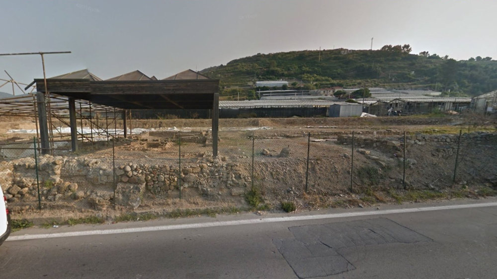
Testimony of the Roman age is still concretely documented by the remains of two rural manor houses to be placed in relation to the agricultural use of the surrounding land.
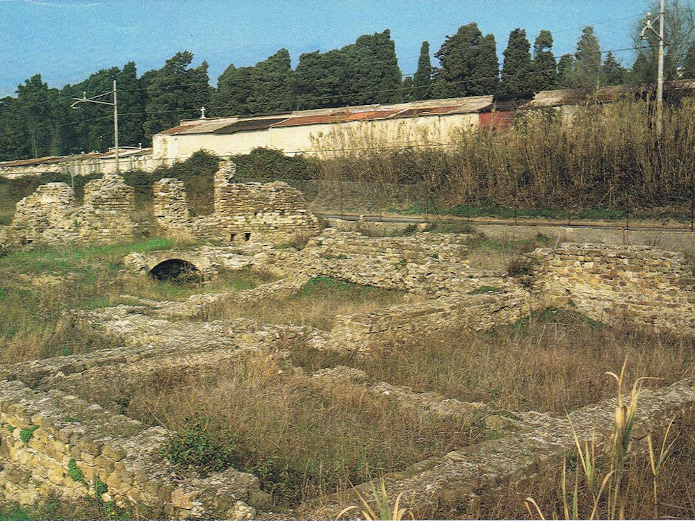


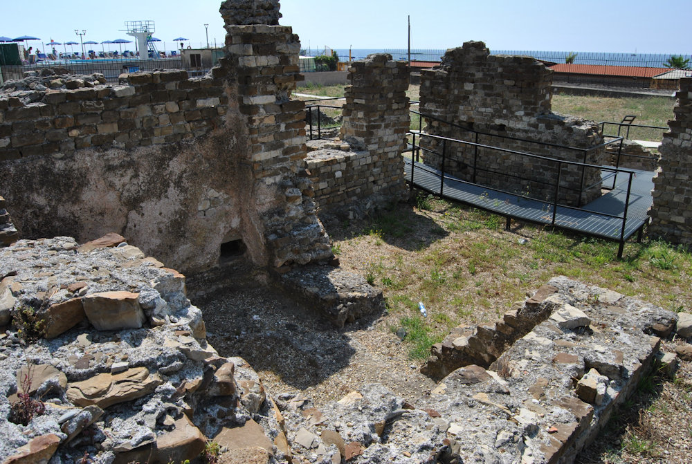
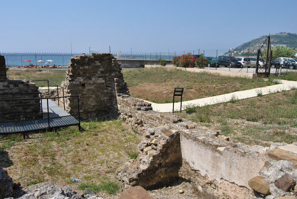
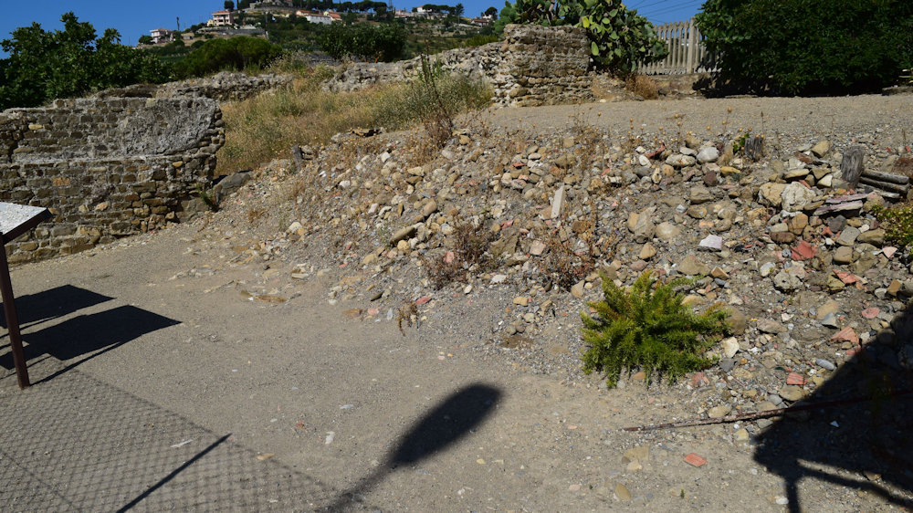
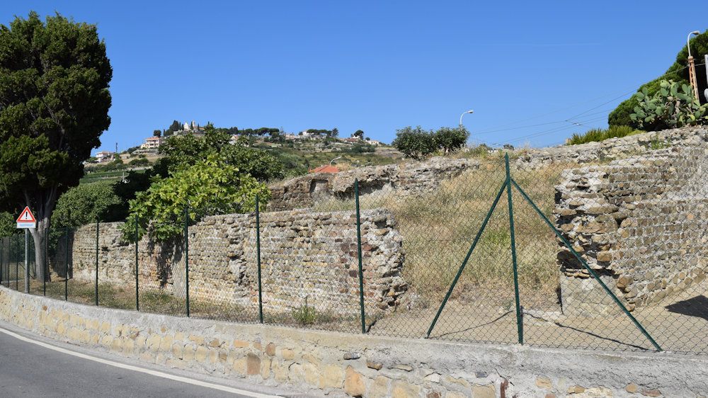
The first, located to the west near the beach, built near the mouth of the homonymous stream, is divided into ten rooms and included a modest thermal complex, with rooms for frigidarium, tepidarium, calidarium. The water was taken from the nearby stream through the special castellum aquae and distributed to the rooms by means of penstock pipes. The masonry and a few other elements date its construction to the II and III century AD)
The fundus in question, in Roman times, was owned by a local Romanised family, whose probable head had the name Mattucius. In fact, some Roman inscriptions found in Nice, Cimiez and Saint-Pons (see here) bear the nobleman Mattucius, a sign that the family had several presences and branches in the Maritime Alps. Villa Matuciae is mentioned in ancient documents (Miscellanea; Antonio Canepa). It may be that the cult observed by the family was that of the Roman divinity of Asian origin, the Mater Matuta, which several sources directly connect to the place name of the village, but the name of Villa Matuciana (or Matutiana) assumed by the locality derives from that of the Mattuci family.
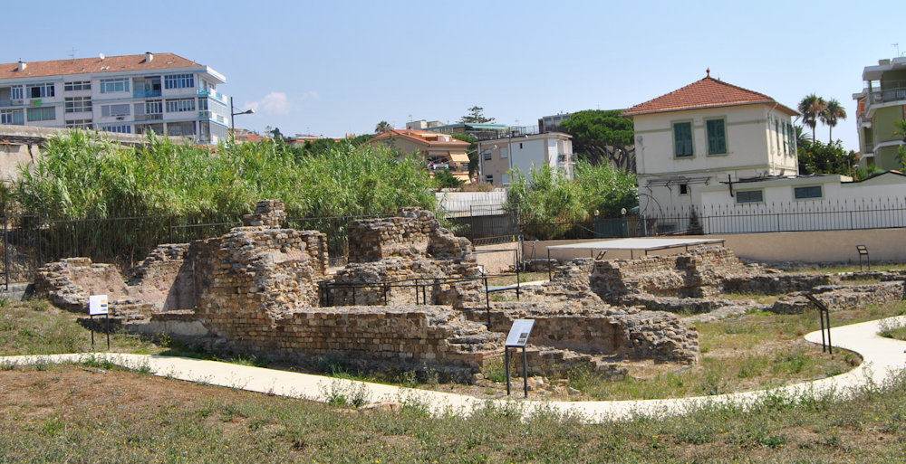
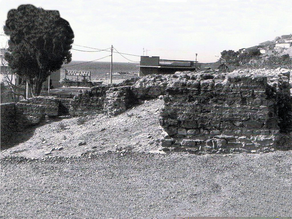 The second villa in Bussana is located to the east between the current Via Aurelia and the railway and the road below (old Via Julia Augusta).
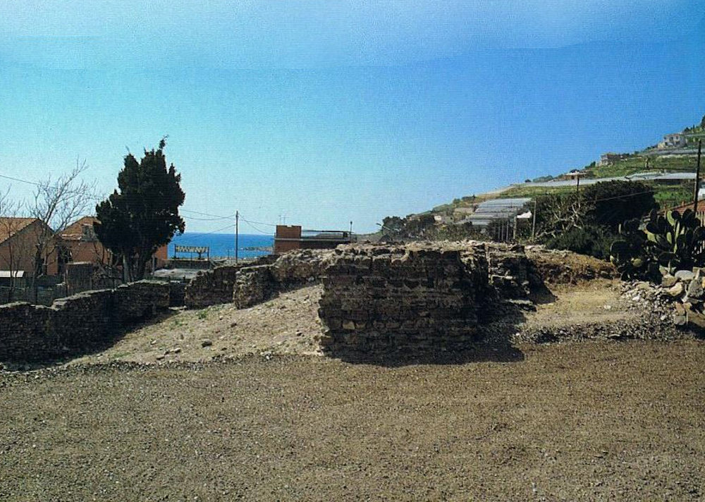 The Roman villa, with a rectangular plan, is an example of a rural building of which five or six regular rooms are recognisable. Recent excavations have brought to light the structures of a kiln and some ceramic materials, which confirm the occupation of the building in the second century AD.
The name of Bussana itself and the place names of nearby areas, such as Porciana, Pompeiana, Ceriana, etc., are indications of an intense population of the area for agricultural purposes.
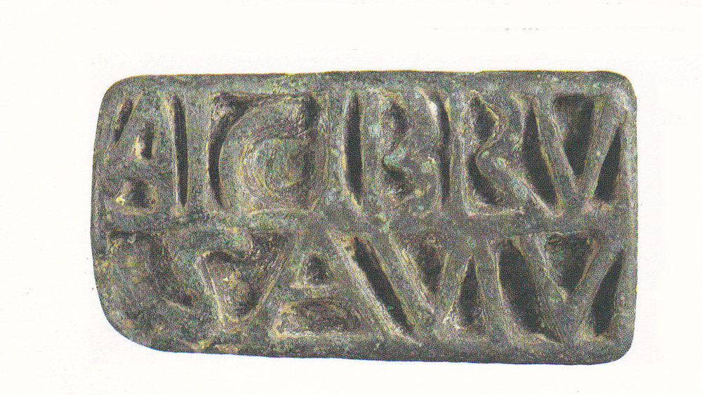 Sporadic discoveries have been reported in several points of the Sanremo territory; among the last, that of a bronze seal with the motto Urbicia vivas, coming from the agricultural region of Solaro, an area already known in the past for the discovery of some tombs of the first half of the first century BC., used by a cultured and unknown Urbicia in personal correspondence, which testifies the presence of an Urbicia gens in the territory of the fundus Matucianus.
 These two important archaeological sites are further evidence of the Roman occupation of the coastal strip. In fact, when the Romans definitively conquered Liguria (115 BC), they concentrated their civil and economic life on the coastal strip, leading to the progressive decay of the primitive pre-Roman nuclei founded by the Ligurians Intemeli, who had extended their dominion from Monaco to Taggia and in the internal valleys according to the organization of the castellars, as we have seen (see Part 1), but these quadrangular structures were abandoned and covered in time by debris and thick vegetation that concealed them from view for centuries.
 Thanks to archaeology, traces of Roman San Remo, the so-called vicus Matutianus, were found. According to the name taken from a document of the Genoese
  bishop Teodolfo dating back to 980, there was a necropolis, as the findings of tombs in the centre of via Cappuccini, a parallel road not far from the route of the Roman road (via Corradi) seem to indicate. The excavation of 1961, although undertaken when five tombs had already been destroyed (only part of the furnishings could be recovered), has allowed us to ascertain that the necropolis, the most important among those of Ventimiglia and Albenga, has the original characteristic that the tombs, of the 'cappuccina' type, are built over the same pit as the funeral pyre and are without the cinerary urn.
The materials used for the tombs include mugs, pateras, phials, cups, an oil lamp and a spheroidal glass bottle, which confirm the date of the necropolis between 80-90 and 100 A.D., i.e. in the most flourishing period of the Imperial Roman Age on the Riviera di Ponente.
Other tombs were found in Bussana in the Armea valley, also along the consular road, in the years 1876-77.

The archaeological excavation directed by Nino Lamboglia in 1960 in the baptistery of San Giovanni near the basilica of San Siro made it possible to identify layers of the Imperial Roman Age (1st-2nd century A.D.) and the Late Roman Age of destruction (4th-5th century A.D.), with floors and wall remains oriented on the same axis as the later early medieval walls and two buildings of the 11th century (the Proto-Romanesque church of San Siro and the Casa Canonica) and are orthogonal to the Roman road (via Corradi).


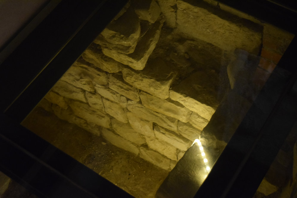
Part of these masonry remains can now be seen under the floor of a bar right next to the Canoniche, made of glass panes through which capitals, walls and tunnels can be seen where it seems there were lodgings for pilgrims in transit.
From the 12th century, however, both the new church of San Siro, built on the ruins of the Proto-Romanesque one, and the church of San Giovanni will be oriented differently.

 The ceramic fragments recovered cover several centuries, starting from the two type "B" bell pottery fragments from the 1st century B.C., the oldest that have come to light, to the most abundant ones from the Augustan age, to the later ones from the Flavian and Antonine ages and up to the fragment of 'light sealed earth of type D', attributable to the 4th century A.D.
The area of San Siro had already given back, in the past centuries, traces of the Roman age. So much so that the historian Gerolamo Rossi reports that in 1636, during the construction of the Oratory of San Germano, « great remains of ancient buildings came to light, with objects of antiquity, and a large number of silver and copper coins, most of which bore the imprint of the emperors Claudius and Flavio Vespasiano.... ».
Nino Lamboglia observed, about the evolution of the primitive San Remo, that after the archaeological investigations carried out in the San Siro area, the Villa Matutiana had « un origin not far away from at least the age of Augustus... a certain destruction at the end of the Roman Empire, between the 4th and the 5th century, a rough and difficult survival during the early Middle Ages and finally a flourishing recovery in the Romanesque age... The topographical continuity between the Villa Matutiana near San Siro, on the orographic right of the San Romolo stream, and the Oppidum Matutianum which in the XI century took the name of Sanctus Romulus, fortified on the left of the stream, appears evident and perfect ».
(Sources: free elaboration from books: "San Remo Storia e anima di una Città by Enzo Bernardini, "Sanremo" by Massimo Bertoletti and Nadia Pazzini Paglieri; images from private archives)